domingo, 27 de mayo de 2012

CITY PUNO

CITY PUNO


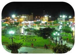
Puno is a city in southeastern Peru, located on the shore of Lake Titicaca. It is the capital city of the Puno Region and the Puno Province with a population of approximately 100,000. The city was established in 1668 by viceroy Pedro Antonio Fernández de Castro as capital of the province of Paucarcolla with the name San Juan Bautista de Puno. The name was later changed to San Carlos de Puno, in honor of king Charles II of Spain. Puno has several churches dating back from the colonial period, they were built to service the Spanish population and evangelize the natives.
Puno is an important agricultural and livestock region; particularly of South American camelids (llamas and alpacas) which graze on its immense plateaus and plains. Much of the city economy relies on the black market, fueled by cheap goods smuggled in from Bolivia. Puno is served by the Inca Manco Capac International Airport in nearby Juliaca.
Puno is situated between the shores of Lake Titicaca and the mountains surrounding the city. There is less than 2 miles of flat land between the shores and the foothills, which has caused the growing city to continue to expand upwards onto the hillsides. As a result, the town's less developed and poorest areas, which are high on the hillsides, often have very steep streets, which are generally not paved and cannot be accessed by automobile.
Up one of these streets is the Kuntur Wasi viewpoint, which has a huge metal sculpture of a condor. There are some 700 steps to climb to reach the sculpture but the view across the city and Lake Titicaca beyond is breathtaking.
Puno is known as the "Capital folklórica del Perú" (folkloric capital of Peru) due to its wealth of artistic and cultural expressions, particularly dance. They are most notable during the celebrations of the Feast of the "Virgen de la Candelaria" and the Regional Competition of Autochthonous Dances. Puno's access to Lake Titicaca is surrounded by 41 floating islands. To this day, the Uros people maintain and live on these man-made islands, depending on the lake for their survival, and are a large tourist destination.
Puno is the first major hub in the constant migration of indigenous peoples of the Andes to the larger cities of Peru. It is the largest city in the Southern Altiplano and is the recipient of new residents from surrounding smaller agricultural communities of poorer class of people seeking better opportunities for education and employment. As such, Puno is served by several small Institutes of Technology, Education and other technical or junior college-type facilities. Additionally it is home to what is commonly referred to as the "UNA" or the Universidad Nacional del Altiplano, which was founded in 1856.

Weather and Climate

As Puno is located at such a high elevation, it experiences more extreme weather conditions than would be expected for its sub-tropical latitude. The average annual temperature is about 15 °C, and the weather never gets overly warm. During the winter months from June to August, night-time temperatures usually drop well below 0 °C. At this high altitude, the rays of the sun are very strong. Most of the annual precipitation occurs during the southern hemisphere summer, with the winter months being very dry.

Folklore


Music and dance are typical parts of the Puno folklore. The most important dances are the Wifala de Asillo, the Ichu Carnival, the Llamerada, the Pujllay of Santiago, the Tuntuna, the Khashua de Capachica, the Machu-tusuj, the Kcajelo, the Diablada, and the Pandilla Puneña.


Handicrafts
Textiles and other products created from alpaca, llama, or sheep wool are characteristic of the area. They also make musical instruments like the siku (wind instrument) and the charango. The Toritos de Pucara are the most impressive ceramic pieces made.


domingo, 18 de marzo de 2012

the city tacna

City Tacna
Tacna is the southernmost region in Peru. Its name originates from the Quechua words taka ("hit") and na ("something to do"), which would mean "a place to hit". This expression is thought to be related to the Quechua conquest of the Aymara people. Its capital is the city of Tacna.
Present-day Tacna Region was occupied by forces from neighboring Chile as a result of the War of the Pacific. Tacna was reincorporated into Peruvian sovereignty in 1929 and today it is known for being one of the most patriotic areas in the country.

Geography

The Tacna Region is bordered by the Pacific Ocean on the west, the Moquegua Region on the north, the Puno Region on the northeast, the Bolivian La Paz Department on the east, and the Arica-Parinacota Region of Chile on the south. The border between the Tacna Region and Chile is known as La Línea de la Concordia.
The region is located below the Titicaca plateau, and has a diverse geography, including volcanoes, deserts and mountainous zones, from which arise rivers that go over the punas and the plateaus, thus forming the hydrographical system of this zone. The region is small in size, but has a great mining and agriculture potential. It has various climates and a diverse production.
History

Prehistoric era

There is evidence of the presence of a very early culture that goes back more than 10 000 years. The archaeological investigations in the region have proved that a civilization dwelled in this zone in the Stone Age. The Toquepala Caves (7630 BCE) and Abrigo de Caru (6240 BCE) belong to this age. There are other sites such as Girata Complex, Mullini, and Queñavichinca, where investigations have not been concluded.

Spanish conquest

The first groups of Spanish conquerors arrived to the region in 1535. These groups were formed by members of the Almagro expedition, organized to conquer Chile. During this time, the city of Tacna was called Villa San Pedro de Tacna. In 1615 and 1784 Tacna experienced violent earthquakes and many towns were reduced to ruins. However, they were rebuilt by their people who decided to stay in the same place.

Nineteenth century

Tacna has a seat of honor in the emancipation process. Since 1810, the local patriots, following the example of their Argentine neighbors, who had already declared their independence, started to conspire. In 1811, Francisco Antonio De Zela, sent forth the first libertarian outcry in Tacna. Once the Peruvian independence was consummated, the heroism of this city was honored by promoting it to the rank of villa on 1823. On May 26, 1828, President José de La Mar promulgated a law given by Congress by which the city of Tacna was given the title of Ciudad Heroica (Heroic City).
During the War of the Pacific against Chile, the tacneños placed themselves in the front line, offering their lives defending the nation.
On May 26, 1880, after the Battle of Alto de la Alianza, the Chilean army invaded the Tacna province and remained there for five decades. Despite this long occupation, the Tacneños kept their national pride high and, finally under the terms of the 1929 Treaty of Lima, the city was reincorporated into Peru.

Maritime dispute

On January 26, 2007, Peru’s government issued a protest against Chile’s demarcation of the coastal frontier the two countries share. Peruvian President Alan García recalled his ambassador to Chile, Hugo Otero, to Lima to consult about the controversy over the maritime boundary the two countries share. According to the Peruvian Foreign Ministry, the Chilean legislatures endorsed a plan regarding the Arica and Parinacota region which does not comply with the current, established demarcation of the border. Moreover, they allege that the proposed Chilean law includes an assertion of sovereignty over 19,000 square metres of land in Peru's Department of Tacna.
According to the Peruvian Foreign Ministry, Chile had defined a new region "without respecting the Concordia demarcation." The Peruvian government maintained that the dispute over the Chilean plan is part of an on-going maritime dispute whereby Chile has tried to use the demarcation process to extend its maritime frontier. Over the past 50 years, Peru has maintained claims over roughly 40,000 square kilometers of ocean territory. For its part, the Chilean government has asserted that the region in dispute is not a coastal site named Concordia, but instead refers to boundary stone No. 1, which is located to the northeast and 200 meters inland.
Given that the proposed Chilean law does not recognize the borderline established by both nations in the 1929 agreement, Peru lodged diplomatic protests with Chile. In the complex territorial dispute, Chile is attempting to modify the border near the Pacific Ocean to fit in the geographical parallel, rather than continuing the national borderline to the sea, which Lima asserts will cut off at least 19,000 square meters of the Peruvian territory.
Nevertheless, a possible border dispute was averted when the Chilean Constitutional Court ruled on January 26, 2007 unconstitutional legislation that Peru said could be seen as a move by Chile to encroach on its maritime territorial sovereignty. While agreeing with the court's ruling, the Chilean government reiterated its stance that the maritime borders between the two nations were not in question and have been formally by the international community.
It has been reported that following the Chilean judicial ruling in Lima’s favor, the likelihood that Peru takes its border dispute with Chile to an international court has been increased by the government and national media. Peruvian Foreign Minister Jose Garcia has expressed that his country may turn to the international court at The Hague but has said that the necessary documents for that action are not ready.
On January 28, 2007 Peru’s leading newspaper El Comercio reported that the President of the Cabinet of Ministers (Consejo de Ministros del Perú), Jorge del Castillo, expressed his grave concern over the pending maritime dispute with Chile.

Political division:

The Tacna Region is divided into four provinces (Spanish: provincias, singular: provincia), which are composed of 26 districts (distritos, singular: distrito).

Provinces

The provinces, with their capitals in parenthesis, are:

Economy

Tacna's main income earner is copper mining. Agriculturally, Tacna produces 53.15% of the whole olive crop in Peru. It also produces maize, potatoes, wheat, cotton, oregano, alfalfa and grapevine (for the production of wine and pisco). It also has a sizable herd of dairy cattle and lamb.
In addition to mining and agriculture fishing is also important, Tacna's sea is abundant in fish resources.

Local customs

Typical dishes and beverages

Tacna offers visitors colorful dishes exquisitely combined and abundantly served. The picante a la Tacneña and patazca Tacneña belong to this region.
Corn and cheese, chicharrones with toasted corn, cuy or guinea pig chactado, corn cake with peanuts and raisins, baked pork, grilled lamb, are also local specialties.
To drink, Tacna has macerated Brussels apricot, frutilla or tumbo, and wines produced in the local vineyards.

Festivities

Carnivals. They are celebrated in different towns and villages with typical local dances that can go on for entire days and nights.
  • April - Corn and Potato Festival in Tacna.
  • May 26 - Anniversary of the Battle of Alto de la Alianza.
  • June 7 - Anniversary of the Battle of Arica.
  • June 20 - Day to remember the tacneño patriot Francisco Antonio De Zela.
  • June 23. Night of San Juan. 
  • August 28. Procesión de la Bandera. A singular and moving civic patriotic act in which the women of Tacna carry the red and white Peruvian flag through the streets of the city. Later, various associations, group of students, and the armed and police forces take part in a parade that ends in the main square, where the Arch of the Heroes is located. For a week the locals celebrate the reincorporating of the Heroic City of Tacna as part of the Peruvian territory. Simultaneously, a fair on farm and livestock products, industrial goods and handicrafts takes place.

martes, 14 de febrero de 2012

ICA

The City Ica
The city of Ica is the capital of the Ica Region in southern Peru. While the area was long inhabited by varying cultures of indigenous peoples, the Spanish conquistador Geronimo Luis de Cabrera claimed it’s founding in 1563. As of 2005, it had an estimated population of over 219,856. The city suffered extensive damage and loss of life during the 2007 Peru earthquake
Location
The city is located on the Ica River about 300 km to the south of Lima, along the desert coast of southern Peru. Further south along the Pan-American Highway lies the city of Nazca.
History
In 2007, researchers found the fossil remains of a prehistoric penguin, Icadyptes salasi, which inhabited the Atacama Desert about 30 million years ago. Scientists estimate it was about 4.5 or five feet tall, with a foot-long beak.
Evidence of prehistoric indigenous civilizations has been found in the nearby deserts, such as that of Paracas. These included the xx, Paracas, and Inca, the last of who were a people who encountered the Spanish. Numerous pre-Columbian archeological artifacts are displayed in the Museum Regional de Ica.
The Spanish colonial city was founded in June 17, 1563 by Geronimo Luis de Cabrera as Villa de Valverde. It was ruled by Spain under colonial rulers until Peru achieved independence.
On 15 August 2007, a magnitude 8.0 earthquakes occurred off the coast of Peru, severely damaging buildings, houses and infrastructure in Ica. Initially 17 people died and 70 were killed when a church collapsed. Pisco was even more severely damaged than Ica, with many people buried under buildings which had fallen; 80% of the city's buildings were destroyed.
Transportation
Ica can be reached from Lima by the Pan-American Highway. The distance is almost exactly 200 miles or 300 km. The trip takes about 4.5 hours by bus and 4 hours on motorcycle.
Tourism
Ica and surrounding areas are the traditional source of Pisco brandy. Ica is the site of the Museum Regional de Ica, a regional museum with exhibits ranging from prehistoric artifacts to the Spanish colonial era. On display are pre-Columbian funerary bundles and mummies, whose elongated skulls from the Paracas and pre-Inca cultures suggest ritual deformation, perhaps a mark of the elite. Some skulls also bear evidence of trepanning; a kind of early brain surgery to relieve internal pressure or remove damaged skull matter suffered in battle. There are also furniture, paintings and artifacts from the Spanish colonial era.
Ica's location in the desert provides unique opportunities for tourism, such as the nearby Huacachina oasis, located in the midst of sand dunes. It attracts international travelers, as well as resort seekers from Peru. Some young visitors try sand boarding; others travel the dunes in sand buggies.
Agriculture
The many days of sunshine have made Ica the center of an important agricultural region. Commodity crops are cotton, grapes, asparagus, olives and other produce. It is known by Peruvians as the "Land of the Sun". Although there are the four seasons, the warm dry climate makes it feels like summer year-round. The climate of the city can help in easing asthma, which is aggravated by damp and humid climates and their associated allergens.
But given the desert climate, agriculture has been relying on an aquifer fed by glacial melt water, and is currently exceeding the inflow of water into the aquifer. The aquifer is quickly drying up, leading to calls for more efficient irrigation, or adding dams and water diversions.

City of Ica

Capital of the Ica Department. One of the most popular places to visit in Ica is La Huacachina. The famous desert oasis is located 5 km from Ica. It is a small lake with medicinal water, lying in the middle of a spectacular sand desert.

Pisco

Pisco the most important port in Ica and a littoral province. The most important attractions within this province are likely Paracas, Paracas Bay and the Paracas National Reserve. Pisco was home of an ancient pre-Hispanic culture, Paracas, who are known for their exquisite textiles.

Paracas

Paracas (a municipality within the Paracas District) is a small town catering to tourism. It serves as the jumping point for tours to Islas Ballestas and to Paracas National Reservation. The beautiful Paracas Bay protected by Paracas Peninsula gives these shallow, warmer waters break from ocean waves permitting life to flourish, particularly near its south western edge encompassed within Paracas National Reserve. The Paracas Museum, also found just near the south western edge of Paracas Bay, provides excellent information about Paracas culture and the many unique species, in particular, the birds of Paracas.

Nazca

The Ica-Nazca culture flourished along the southern coast of Peru from around 200 BC to 600 AD. This area is extremely dry. The Nazca developed extensive irrigation systems, including underground canals that allowed them to farm the land. The Nazca are known for their beautiful textiles and pottery which feature images of animals and mythological beings.
They are even more famous, however, for an extraordinary but puzzling set of creations known as the Nazca Lines, which are geoglyphs and geometric line clearings in the Atacama desert, in the district of Nazca. On a large, rock-strewn plain, the Nazca made huge drawings by scraping away stones to reveal the lighter soil underneath. The drawings depict various plants and animals, including humans, a monkey, birds, and other creatures, as well as lines and geometric shapes. These drawings are so huge, however, that they can be seen only from the sky. Scientists believe that the Nazca made these drawings for their gods. The area of the Nazca lines is called the Pampa Colorada (red plain).

Cachiche

A small village near Ica, Cachiche is well known for its history of witches. Doña Julia, Cachiche's first witch, was known to practice "good magic," curing and helping villagers with her spells. Near the entrance to the town, a carving from a single huarango tree depicts this first "bruja de Cachiche" (witch of Cachiche).


martes, 18 de octubre de 2011

PUNO

The city puno
Puno is a city in southeastern Peru, located on the shore of Lake Titicaca. It is the capital city of the Puno Region and the Puno Province with a population of approximately 100,000. The city was established in 1668 by viceroy Pedro Antonio Fernández de Castro as capital of the province of Paucarcolla with the name San Juan Bautista de Puno. The name was later changed to San Carlos de Puno, in honor of king Charles II of Spain. Puno has several churches dating back from the colonial period, they were built to service the Spanish population and evangelize the natives.
Puno is an important agricultural and livestock region; particularly of South American camelids (llamas and alpacas) which graze on its immense plateaus and plains. Many homes in Puno, much like surrounding cities, are half-finished. This is done so that the inhabitants do not have to pay taxes. Much of the city economy relies on the black market, fueled by cheap goods smuggled in from Bolivia. Puno has been designated to become a Special Economic Zone or "Zona Económica" by Peru's president, Alan Garcia. Puno is served by the Inca Manco Capac International Airport in nearby Juliaca.
Trivia & Quick Points:
  • Puno has been designated to become a Special Economic Zone or "Zona Ecomomica" by Peru's president, Alan García.
  • The area surrounding the city of Puno was where the Aymara civilization started.
  • Puno has been named the "Capital folklórica del Perú" (folklore capital of Peru) from its wealth of artistic and cultural expressions, particularly dance.
  • Knitting and textile arts have been practiced for thousands of years by both the men and women equally on the island of Taquile, (Isla Taquile) in the middle of Lake Titicaca.
Facts & Information:
History:
Like most of northern Peru, the territory of Puno's importance to the vast Inca empire was reflected in a legendary connection. Inca tradition has it that Manco Capac, the first Inca, rose from the waters of Lake Titicaca, under the orders of the Sun God, to start the Inca Empire, which would be centered in the neighboring region and city of Cuzco.

In 1668, viceroy Conde de Lemos established San Juan Bautista de Puno as the capital of the province of Paucarcolla. Later, it was called San Carlos de Puno, in honor of the ruling king, Charles II of Spain.

From that moment, the town began to change physically, as the Spanish priests, in their eagerness to evangelize the natives, built the churches which still stand today.

Culture & Folklore
Puno has been named the "Capital folklórica del Perú" (folkloric capital of Peru) from the wealth of its artistic and cultural expressions, particularly dance.

They are most notable during the celebrations of the Feast of the "Virgen de la Candelaria" and the Regional Competition of Autochthonous Dances.

Travel & Tourism:
The city of Puno, Peru is a popular tourism and traveler's destination for a few reasons, the most obvious being the fact that it's located on the shore of world famous and fascinating Lake Titicaca.

The other reason Puno sees a lot of travelers is because it offers relatively easy border crossing choices to Bolivia- which is just on the other side of the lake.

Many Peruvian travelers use Puno as a basecamp to a Bolivian vacation.
The City of Puno
Sightseeing highlights around the city include obligatory visits to the Church of San Pedro, the Sistine Chapel of the Americas, and to the shoreline of Lake Titicaca at the Puno harbor. There, you can stroll along the boardwalk, spend your money at the giftshops, take endless pictures, check out the boats, and even visit a Titicaca boats museum.

There's also quite a lively nightlife for a city of this size, due to the large numbers of tourists from all over the world mixing it up with the plethora of artists and musicians of Puno.
Hiking around Puno-
Walking up in the hills just outside the city of Puno affords nice views of the city and lake, but it is quite dangerous! Locals recommend against doing it because tourists are often the victims of armed robberies in the hills.

If you like hiking, here's an idea: take a colectivo to Chuciuto (19km, 1 Sol, US$ 0.30) and start hiking from there. Next to the highest mountain (with a thin antenna on the top, 4550m) there is a summit where locals bring sacrifices. Fireplaces, flowers and bottles give witness of that.

Beyond the city of Puno, the surrounding area offers lots more touring and sightseeing options.

What to Do & See in the Surrounding Area
Here's 3 key attractions of the Puno region we recommend. There are many more, depending on your time constraints.
Floating Reed Islands of the Uros-
Lake Titicaca has some 41 floating reed islands on it that are an interesting experience for any traveler. These man-made islands have a fascinating history and story behind them.

Although in modern times it can be argued that they are a bit "touristy" and somewhat artificial, it is also a fact that for thousands of years up to now, the Uros people have lived on and maintained these unique Peruvian islands, depending on the lake for their survival.

Many tour companies offer trips to these reed islands, (as close as 20 minutes from Puno) and some combine reed island stopovers with organized tours of wonderful Taquile island. (a 3 hour boat ride and then spend a few hours on the island.) Definitely go for this combo tour if you have time... it's great! (and there's a lot more to see and do on Taquile island than the little reed floaters.)

These tours can be organized from both Copacabana and Puno.
Lake Titicaca-
Another great reason for getting out to the reed islands or Isla Taquile is because this gives you a chance to experience the magic and desolate beauty of Lake Titicaca, the world's highest elevation commercially navigable lake.

Seeing the scenery around you, breathing the clean air, and marveling at the magnificent greenish blue colors of the lake will give you a new perspective of this region and the body of water that has played such a key role in it's history.
Isla Taquile-
is a fascinating time capsule of wonderfully preserved Peruvian and Bolivian cultures, having stayed the same now for thousands and thousands of years.

If you have time, consider seeing the other islands of the lake as well: Isla Amantani, a 4 hour trip from Puno with boats leaving daily at 8:30 am and also Isla del Sol, easily reachable from Bolivia's Copacabana.
Sillustani Burial Towers-
Hundreds of years ago, the ancient people from the Altiplano, that lived at the shore of the mystical Lake Titicaca, built a series of funeral towers to bury their kings and other important people of their regions.

The Sillustani towers are perhaps the finest and most perfect cylindrical constructions of ancient Peru, as such perfection can be found nowhere else in South America.

A tour to Sillustani will give you a better view into the life of pre-Inca civilizations, and exploring the area, you can marvel at the great beauty of the Umayo Lagoon, which is located at the foot of Sillustani.
Getting There & Away
  • By Plane:
    Puno is served by the Inca Manco Capac International Airport in nearby Juliaca. Although there are international flights arriving to this airport, you are well advised to price out your trip by way of Lima.

    Puno.com recommends comparing various airlines and ticketing agents with our Travel partner Booking Wiz. (see widget on top right of page)
  • By Bus:
    Daily buses depart to and from Cuzco and Arequipa. The ride from Puno to Cuzco takes about 8 hours. There's a night bus leaving Puno at 19:30 and arriving in Cusco at 4:30 am.

    Daily buses depart to and from La Paz, Bolivia on two slightly different routes:
    1) The direct route, (faster.)
    2) Via ferry boat across Lake Titicaca and Copacabana. (more interesting)

    It's a good idea to change some Peruvian money at the border in order to be able to pay the ferry in Bolivianos. Be prepared to change buses in Copacabana. (you might lose your good seats.)
  • By Train:
    Trains to and from Cuzco travel to Puno only 3 times per week. Other trains travel to Arequipa.
Getting Around
Most people get around town by foot... Taxi's and mini vans are not hard to find for longer distances. They are called "collectivos".
Food and Eating Tips
Most tourist spots are in and around Calle Lima. A little bit of bargaining will get you a discount, but don't push it too far if you want your food prepared without any bodily fluids.

In and around the mercado central are several budget places to eat for less then 3 soles. Also try a fruit juice at one of the many juguerias on the second floor.
  • Cafe restaurant Monterrey- at Pasaje Grau 158, has reasonably cheap and good breakfasts.
  • Restaurant pizzeria Ollantay- at Pasaje Grau 160, has pizzas, trout and alpaca. Ask for el menú.
Taking Photos
If you enjoy documenting your experiences with photography, a phenomena you are sure to encounter in Puno is that MOST locals seem to hate getting their pictures taken. Unless you've got a long lens, catching a natural shot of a local is a challenge.

At first you may chalk this up to thinking the people are just camera shy, but it's actually much more than that. Once you learn about the local culture, religions, and superstitions, you will discover that most locals believe that your camera sort of "sucks out their soul" when you capture their image. They are quite adamant about avoiding looking into your lens. We recommend you be understanding of this idea and respectful to the people- and don't push them...

So what's the best way to get a great shot of a local "being natural" Smiling helps, and paying money is always a good strategy...